A laser scanner with a LiDAR sensor is an active detection technology device capable of digitally reconstructing environments of any type, external or internal. It offers high accuracy, requires no GPS signal, and works well even in dimly lit environments.
Precise
High precision measurements (up to 1,0 mm)
Fast
The high scanning speed guarantees unmatched acquisition times
Profitable
No interruptions and competitive costs compared to traditional surveying
3D Laser scanner survey
3D modelling
Digital Twin
ARCHITECTURAL | STRUCTURAL | MEP
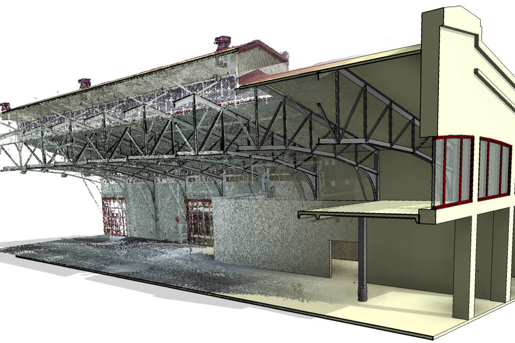
As Built & Scan to BIM
We develop BIM 3D model and project documentations, based on spatial surveys, able to describe the actual state of a building object or geographical space. This type of documentation is used both in the construction phase on pre-existence and to describe the actual state of completion of a work and highlight any differences between design and implementation.
This website or third-party tools used by this website, uses cookies for functional and analytical purposes. Third-party profiling cookies may also be present. If you want to learn more or opt out of all or some cookies, see our Privacy PolicyAgree
Privacy & Cookies Policy
Privacy Overview
This website uses cookies to improve your experience while you navigate through the website. Out of these cookies, the cookies that are categorized as necessary are stored on your browser as they are essential for the working of basic functionalities of the website. We also use third-party cookies that help us analyze and understand how you use this website. These cookies will be stored in your browser only with your consent. You also have the option to opt-out of these cookies. But opting out of some of these cookies may have an effect on your browsing experience.